Thursday, July 19, 2012

Thursday, July 19, 2012. Belle Maer Harbor.

We left Lexington in the morning in overcast and drizzly weather. After traveling an hour and a half south, we reached the buoys at the entrance to the St. Clair River and passed under the Blue Water Bridge by Port Huron. In the upper St. Clair River a rainstorm hit us. We slowed down a bit, but otherwise the wind and rain didn't effect us too much (love the pilothouse!), and the visibility wasn't bad. A bass fishing tournament was being held on the river, and the fisherman were out in their open bass boats in the rain. They really earned their prize money today!

St. Clair River (epa.gov)


By the time we reached Anchor Bay the weather had cleared some and we were soon back in our slip at Belle Maer, home sweet home!

Belle Maer Harbor (thefishinghome.com)

 In retrospect, this trip for me was a great experience. Cruising like this has always been a dream of mine. Early in our marriage I assumed it would not be possible because of K's seasickness issues. However, several years ago we took an overnight trip on Lake Michigan with friends Bob and Mary on their boat. We both enjoyed the trip and K did not have any seasickness. This led to our getting into boating and eventually buying our current boat.

We enjoyed visiting a lot of different harbors, and we stopped in different towns on the way down the coast of Michigan than we did on the way north. We really enjoyed cruising with a "buddy boat", and we were fortunate to benefit from Kelly and Deb's experience. We learned about our boat's capabilities and I was impressed with her design and quality. K felt comfortable and secure most of the time onboard. We gained experience in handling the boat and in anchoring overnight. K and I enjoyed each others company while traveling in the enclosed space of our boat for 3 weeks! We look forward to doing more cruising and visiting new areas.


Wednesday, July 18, 2012

Wednesday, July 18, 2012. Lexington.

We left Tawas Bay in clear weather with a chance of showers and thunderstorms, and while crossing Saginaw Bay the Coast Guard gave a weather alert over the VHF radio of squalls possible from Lake Erie through the Detroit River, Lake St. Clair, and Lake Huron. We traveled at about 10 knots to try to reach our destination of Port Sanilac or Lexington before the weather worsened, with plans to turn off at Port Austin or Harbor Beach if needed. It turned out the weather was good all the way to Lexington, although the wind picked up just after we tied up at the Lexington State Marina.

Lexington Harbor (michigan.gov)


Lexington Marina (lexingtonmichigan.org)
When we passed Port Sanilac we looked to see if we could pick out Mom and Dad's old cottage on the shore. I could tell when we were between Applegate Rd. and French Line Rd. but I couldn't see the cottage. I think it was hidden by trees.

In Lexington we ate dinner at the Cadillac House where we had picked up many a pizza while staying at the folk's cottage with the girls. A nice little town, but the shops were mostly closed up in the early evening when we were there.

Tuesday, July 17, 2012

Tuesday, July 17, 2012. Tawas.

This morning I took Daisy for a walk along a beautiful path in the pine woods near Presque Isle State Docks. The path had a cedar smell and it was cool, dark, and damp, and it opened to the light house and museum nearby. The view of the bay lined with pine trees was beautiful!

Daisy rested up while we were underway


We cruised south along the coast with North winds following us. By the time we passed Harrisville, the waves had risen to three to five feet. The autopilot did not do well in these following seas so I had to steer by hand the last hour and a half (seemed longer!). The boat handled well and we arrived at Tawas Bay and were happy that a squall passed just west of the harbor as we arrived. We were tired! Sometimes it is such a relief to tie up snug and safe at a nice marina.

East Tawas State Dock is a nice marina but it is a long walk to get off the docks. Also there is a railroad track adjacent to the docks. We awoke at 2:30am to the sound of two long whistles and two short. I was sure a ship was signalling he was going to pass on our port side. I even looked out the window and thought I saw a freighter going by the marina (not likely!). When I woke up a bit more I realized it was a freight train going by on the railroad tracks just outside the marina entrance.

Monday, July 16, 2012

Monday, July 16, 2012. Presque Isle.

After leaving Les Cheneaux Islands we returned to Mackinaw City Marina where we spent two nights. Kelly and Deb left their boat on Sunday to return to Jackson. We had a nice visit with friends Charlie and Mary who drove over from their condo in Petoskey.

Shepler Ferry Dock, Mackinaw City. Fuel pump is at the right. (panoramio.com)

This morning we fueled up at the Shepler Ferry Dock and began our return home down the Michigan coast of Lake Huron. On our way the Port Huron to Mackinaw Sailboat Race was coming to a close. Several boats dropped out and we listened to the VHF radio as they were required to alert the Coast Guard when the did so. They were asked by the guardsman the reason for dropping out. One said, "mechanical failure in my rigging", another said, "the wind is dying and it's no fun anymore!"

We arrived at Presque Isle State Docks and found this to be one of the most beautiful spots on our trip. There are two lighthouses, one working and one a museum. The marina has a very good restaurant and the water was especially clear. Cousin Shad drove up from Alpena and joined us for dinner. He took us for a ride in his vehicle around Grand Lake. We had a great visit.


Presque Isle Harbor (michigan.gov)

Old Presque Isle Light (unc.edu)

Friday, July 13, 2012

Friday July 13, 2012. Les Cheneaux Islands.

This morning we left our Lime Island anchorage and traveled down the remainder of the St. Marys River. We passed a freighter awaiting apparently major repairs or scrapping while tied down on the west side of the riverbank. We also passed a cottage which is the front part of an old freighter which was scrapped, the John Boardman.

John Boardman freighter cottage (ipr.interlochen.org)


We passed the DeTour Reef Light and cruised to Les Cheneaux Islands again. We anchored for the night back at Government Bay. I got the dinghy down and K and I and Kelly and Deb drove upstream a couple miles to the little town of Cedarville for dinner.

De Tour Reef Light

While I was tying up our dinghy to the swim platform a speedboat came over to check out Breathin' Easy. The lady driving it said "Isn't that Doc Albertson?" It was the wife of one of my patients. She is also a friend of K's, and they have a cottage in the area. The next morning after anchoring in Government Bay with about 5 other boats, a man came over to our boat in his dinghy and it turned out to be K's dentist! Small world...

Government Bay


Sunrise in Government Bay


Anchoring overnight in a place like Government Bay is a quiet peaceful experience.The stillness of the night, the fresh clean air, and the beautiful pines ringing the bay made this a special part of our trip.  Now I understand why Kelly asked us before the trip if we were the type of people who needed to have the generator on all night to run the air conditioner!

Thursday, July 12, 2012

Thursday July 12, 2012. Lime Island again.

This morning we toured the Valley Camp Museum, which is an old freighter docked next to the Kemp Marina in Sault Ste. Marie. The ship carried bulk goods from 1917 until 1967. It was turned into a museum which has exhibits showing all parts of the ship, displays of native fish in large aquariums, and a lifeboat from the Edmund Fitzgerald. We looked at the sleeping quarters and eating areas of the hierarchy of crew members from ordinary sailors to the captain, and the pilot house.

Valley Camp Museum (greatlakesdigitalimaging.com)


We then left the Soo and traveled downstream on the St. Marys River. We followed the Mesabi Miner, one of about a dozen Great Lakes freighters of 1000 foot length (we saw several others of this group on the trip). The downstream maneuvering for these ships is very convoluted and difficult. At one point the Mesabi Miner appeared to have its propellers in reverse to negotiate a tight turn. Because of the current  and its momentum it continued to travel downstream at about 3 knots in this area. Bumping the edge of this narrow channel would not do anyone any good!

Mesabi Miner stern view (photography-on-the.net)

Mesabi Miner bow view (greatlakesfreighters.4t.com)


Tonight we anchored out for the first time. We went to the southeast side of Lime Island just north of DeTour Village, where we had tried to anchor on the way up. The weather was great this time. We brought the dinghy down and took Daisy ashore. The anchorage was peaceful and quiet. I set an alarm to wake up at 2:30am to see if we were dragging anchor and we hadn't budged.

Dinghy Swashbucklers

Wednesday, July 11, 2012

Wednesday, July 11, 2012. Sault Ste. Marie

This morning Kelly and Deb joined us on Breathin' Easy for a trip through the Soo Locks. We had never been through a major lock before and we appreciated their help. The American Soo Locks are larger and all the freighters use them, whereas the Canadian Soo Lock is smaller and is used by the tour boats and pleasure craft. The process turned out to be straightforward. We entered the lock at the lock masters' instruction (green light was turned on) and came alongside the north wall. We looped two lines around vertical plastic coated cables at the stern and the midpoint of our boat. The doors of the lock closed and we were raised 25 feet as water entered the lock. The upper gates opened and out we went. The hardest part was keeping the boat in position in the river current prior to entering the lock. The process reversed on our way back as we were let down 25 feet to the downstream level.

Soo Locks, Canadian Lock on left (from Wiki)
Canada Soo Lock (tripadvisor.com)


After going through the lock we cruised up the St. Marys River to Whitefish Bay. We went as far as the Iroquois Point Light, just far enough to say we touched our hull into Lake Superior!

We returned through the lock and tied up at the George Kemp Marina again. After dinner we watched a concert of a large steel drum band and walked around Sault Ste. Marie ("walk around" a town usually implies ice cream was consumed).  Kelly and I went to the observation platform to watch a huge freighter lock through the American Soo Lock. There appeared to be only a couple of feet clearance on each side!

Tuesday, July 10, 2012

Tuesday, July 10, 2012. Sault Ste. Marie


We left Lime Island and cruised up the St. Marys River this morning (there is no apostrophe in "Marys"). We passed the Round Island Lighthouse (not the light of the same name by Bois Blanc Island), which is now a private residence.


St. Marys River Round Island Lighthouse, from roundislandlighthouse.com


 We were passed by the freighter Saginaw. This freighter is 639 feet long, 72 feet wide, and has a 7000hp steam turbine engine, with a maximum service speed of 16mph. She certainly zipped past us!


Saginaw upbound just past Lime Island where we had spent the night, passing Believer


 The St. Marys River splits into one way branches around Neebish Island, and we took the upbound (eastern) branch to Sault Ste. Marie.This is tricky navigating for freighters, and there are lots of aids to navigation and more range markers than I have seen anywhere here.

We arrived at the George Kemp Marina for a two day stay. A couple of blocks from the marina is the Antler Restaurant, famous for its decor (walls covered with stuffed animals) and its birthday greetings (lots of chimes and whistles)!

Antler Restaurant, from senicpathways.com

Monday, July 9, 2012

Monday, July 9, 2012. Lime Island, St. Marys River

We left Mackinac Island in the company of Believer, Kelly and Deb's boat, and headed northeast across Lake Huron. We stopped in the Les Cheneaux Islands (French for "The Channels") and anchored in Government Bay for lunch and a nice nap (my kind of travel!). Then on to De Tour Village at the entrance of the St. Marys River into Lake Huron.


Leaving Mackinac Island


De Tour Reef Light at entrance of St. Marys River into Lake Huron


We thought we would anchor overnight at Lime Island, but after we dropped our anchors on the east side of the island, away from the freighter channel, a 25 knot wind blew up from the north and threatened to drag the boats at anchor. Kelly felt this would not do! We pulled up the anchors and drove around Lime Island and tied up at an abandoned loading dock on the west side of the island, well protected and a great place to spend the night.


Abandoned loading dock at Lime Island


Lime Island was a freighter refueling station at one time, but this operation is now abandoned. What this island now has is the largest colony of Common Terns in the Great Lakes. These birds (sterna hirundo) live in colonies and they migrate to Atlantic coastal Florida, the Carribean, and South America. When feeding they hover over the water and dive underwater to catch small fish. In the  past over 6000 breeding pairs lived in Michigan, but now there are only 1600 pairs and they are listed as a "threatened species". The small piece of land where we tied up for the night was actually where a number of terns were nesting. The area was protected by an electric fence to keep out predators. The birds were very protective, dive bombing anyone who got too close to their nest.


Common Tern, from Wiki

Common Tern sanctuary

Tern eggs, mother is nearby


Lime Island also has a nice boardwalk through the woods overlooking the water with platforms for remote camping. There are also some huge fuel tanks left from the days when freighters stopped here to refuel. While tied up overnight at the Lime Island loading dock, I awoke in the middle of the night to see what appeared to be a small city floating by- a huge freighter all lit up! It seemed awfully close to us but we were protected from its wake by the small spit of land which we were docked against.

Sunday, July 8, 2012

Sunday, July 8, 2012. Mackinac Island

Today was a rest day with no traveling. Early this morning I walked Daisy up to the arch rock past Mission Point Resort. She was very enthusiastic at the start but as she got more tired she wanted to stop and do more sniffing on the roadside. She must have a huge olfactory lobe in her dog brain! Mackinac Island in the morning before many visitors arrive is always very tranquil and beautiful. There is a pretty walking path near the lake shore opposite Mission Point with some wildflowers and a little pond where a frog was croaking. We had the whole place to ourselves.

At lunch we had a visit from one of our god-daughters, Liz Balcom, and a friend of hers. They are doing internships for their Michigan State University programs at the Mission Point Resort. K had found this out from Liz's mother and called Liz when we arrived on the island. She fixed the girls lunch and they were excited to have home-made food ("a fresh real tomato!"). We took them on a boat ride on Breathin' Easy around Mackinac Island, the first time we had done this also. The weather was sunny and tranquil and we all had a great time. Our visit with Liz was one of the highlights of the trip!


Cruising around Mackinac Island


Saturday, July 7, 2012

Saturday, July 7, 2012. Mackinac Island


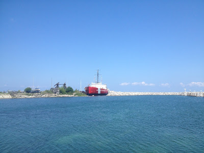
Next to the Mackinaw City  Marina is docked the decommissioned US Coast Guard ice breaker Mackinaw, which has been made into a historical exhibit. We visited the ship this morning.


Icebreaker Mackinaw Maritime Museum
Bow of the cutter Mackinaw
Mackinaw's diesel engines powering electric generators


The cutter Mackinaw was commissioned in 1944 and was the largest icebreaker in the world at the time. The Mackinaw has three propellers, two in the stern for propulsion and one in the front to churn up the ice and help push it out of the way. The 290 foot ship is powered by six diesel engines which are generators powering electric motors which actually drive the propellers. To keep the Great Lakes industries competitive in international markets, the shipping channels need to be open about ten months each year. Most years this requires opening a channel through ice in March. The Mackinaw has been replaced by a new Coast Guard icebreaker which requires a smaller crew and is cheaper to operate.

After our tour of the icebreaker Mackinaw we began our week cruise with Kelly and Deb. Their boat is a 44 foot Beneteau sailboat named Believer. To cruise together we slowed down a bit from our usual cruising speed of 8.5 to 10 knots to about 7-7.5 knots (depending on the current) if they were motoring,  and faster if they motorsailed.


Believer approaching Mackinac Island


 Our first stop was Mackinac Island where we each had reservations for two nights at the state docks. A short trip across the Straits involved staying away from the many ferries.  It is always great to safely tie up at the dock, even more so at the Mackinac Island docks we have walked by so many times on past visits. We look forward to having two days to rest here after traveling every day for the the past week.


Mackinac Island Harbor

Mooring field and Mackinac Island State Docks
Arnold Transit Company dock across from state docks

Friday, July 6, 2012

Friday, July 6, 2012. Mackinaw City

This morning we fueled up and left Rogers City. We passed the Poe Reef Light and traveled up the South Channel between Bois Blanc Island and Cheboygan. It was a real thrill to see the Mackinaw Bridge as we rounded the corner of Bois Blanc Island! We motored up the Straits of Mackinac and drove under the Bridge and then back to Mackinaw City where we docked at the Municipal Marina. Our slip there was across the dock from friends Kelly and Debbie Osborne of Jackson, who came out in their sailboat to meet us outside the harbor.
Poe Reef Light off the southeast corner of Bois Blanc Island, northern Lake Huron

K and I have always loved the Mackinaw area. Mackinac Island is the one place we vacation just about every year. To see the island, the Mackinaw Bridge, the Old Round Island Point Light, and these waters from our own boat was very special. We have found that after we visit an area from the water our perspective of that area broadens and we have a better feel for it. I think that will be true of the Mackinaw area.
 
Approaching Mackinaw Bridge from the South Channel

We never saw this view of the bridge from the Mackinac Island ferry!

Thursday, July 5, 2012

Thursday, July 5, 2012. Rogers City.

This morning Shad bicycled down to the city docks and we had a visit before K and I left Alpena. We passed several shipwreck sites in Thunder Bay, and cruised east of the Thunder Bay Island Light. This is an important lighthouse for northbound vessels so they do not cut across shallow rocky shoals as they turn toward the Straits of Mackinac. Heading northwest we cruised 6 1/2 hours to our destination tonight, Rogers City.

Thunder Bay Island Light

We stayed far enough from shore to avoid shoals around the northeast corner of the Lower Peninsula. We approached Calcite, an industrial port just east of Rogers City. Several freighters crossed north of us heading toward Mackinac, and I steered well south of them, out of their way. One ship seemed to be heading closer and closer to us, in the same direction we were headed. I realized he was headed to the port of Calcite. Since we were ahead of him heading to Rogers City, I decided to call him on the VHF radio to see what his plan was so we could avoid crossing in front of him. The freighter was the Joseph H. Thompson. The conversation ran as follows:

Breathin' Easy:  Joseph H. Thompson, this is the motor vessel Breathin' Easy, over.

Freighter: This is the Joe Thompson, go to channel 8, over.

Breathin' Easy:  Joseph Thompson, this is Breathin' Easy. It looks like you are headed to Calcite. Can you tell me where you would like me to go to stay out of your way as you come in?

Freighter: Are you that little white boat off my port bow? Well, I guess you can go anywhere you want, like a flea buzzing around! Anyway, I have to wait out here until the ship at the dock is finished loading before I can go in...

Joseph H. Thompson  (dlund.20m.com)

Joseph Thompson, stern view of dedicated tug (images.mitrasites.com)


The freighter Joseph H. Thompson was initially built in 1944 as a 515 foot cargo vessel named Marine Robin. During World War II she made trans-Atlantic voyages for the war effort and was present at the Normandy Invasion on June 6, 1944. In the 1950's she was given a new 199 foot midsection making her the largest freighter in the world at the time at 714 feet long, and she was renamed the Joseph H. Thompson. In the 1980's she was remodeled again into a self-unloading barge. Her aft and fore cabins were removed and her stern was redone to make a notch for her push vessel. A dedicated tug was constructed with left over steel from the larger vessel's hull. She is now 706 feet long with a capacity of 21,200 tons. As a self-unloading barge-tug combination she is efficient enough to compete with newer freighters. (From www.boatnerd.com).

Rogers City Marina


We docked at the Rogers City Marina. A waterfront park has a bandshell where a concert was given this evening by a community band. The theme was "patriotic music" in honor of the Forth of July. We sat in the park next to the trombone player's wife. The music was great and the audience appreciated the performance. Wonderful small town Americana!
Rogers City bandshell


Sunset at Rogers City Marina

Wednesday, July 4, 2012

Wednesday, July 4, 2012. Alpena

This morning we left the Port Austin State Dock and traversed the thick weeds of the harbor with the jello-like feeling we noticed coming in, and I was happy to get into clear water! We crossed the northern part of Saginaw Bay to the west to Au Sable Point.

Crossing Saginaw Bay was the first time K and I had been out of site of land on either of our cruisers. We navigated with our MacENC laptop which has its own gps antenna, and we have two back up gps systems: the boat's built-in chart plotter and my iPhone Navionics system. We also had a portable Garmin chart plotter but it ran out of batteries and stopped working after a few days even though I plugged it into the cigarette lighter at the helm! In addition to the electronics I kept track of our position by dead reckoning, which means simply traveling a constant speed from a known position fix at a known course bearing. If you know how much time has elapsed since the last fix you know where you are. On this trip I used a kitchen timer and marked our position on our paper chart every hour. Electronics are nice but I really enjoy using paper charts and we had them for all the waters we traveled.

The water was smooth across Saginaw Bay and we turned north and went up the Michigan shore to Thunder Bay. Our stop tonight was Alpena, and the city is about 9 miles to the west from the buoy marking the bay entrance. We docked at the city dock, which is called the Thunder Bay Shores Marina. My cousin Shad lives in Alpena and we were anxious to see him and Anna. Shad took us on a tour of the town and his house. We were unable to see the Great Lakes Heritage Maritime Center in Alpena due to the time we arrived, hopefully we can visit next time we come by. Since it was the Fourth of July, a concert was being held outdoors by the waterfront. We grilled hamburgers and watched fireworks from the boat and had a great visit with Shad and Anna.


Pride of Michigan docked at Alpena


At 11:30pm a vessel pulled up to the docks called the Pride of Michigan. I recognized it as it had spent the winter docked at the Clinton River in Harrison Twp, using a bubble system to prevent ice damage. This ship turns out to be a former Navy training vessel which is now used by naval cadets with the Noble Odyssey Foundation. This is a non-profit organization which takes youth on 5-10 day trips to learn different skills. The group we saw was a diving group. Thunder Bay has a lot of wrecks and is known for its scuba diving. The ship Pride of Michigan was built in 1979, is 80 feet long, 75 tons displacement, and has twin rebuilt diesels. It is built of wood, and the cadet I spoke to said the bilge pumps are on continuously!

Tuesday, July 3, 2012

Tuesday, July 3, 2012. Port Austin.


Today we entered Lake Huron from its southernmost point at Port Huron (noaa.gov)
 We left River Street Marina in Port Huron at 7:30 am. As we were leaving the dock an older gentleman came up the sidewalk on a bicycle and spoke to me. "I know you must get tired of hearing this but you have a really beautiful boat! I love Ocean Alexanders!" I answered that no, I haven't gotten tired of hearing it and thanked him for the compliment. As we took off down the canal he followed on the sidewalk awhile admiring the boat! It was a nice way to start the day.

Blue Water Bridge between Port Huron and Sarnia

 We passed a few high performance sailboats docked along the Black River for the upcoming Port Huron to Mackinac Race. After cruising under the Blue Water Bridge we entered Lake Huron for the first time on Breathin’ Easy.

Today was our first experience with what boaters call "uncomfortable" weather in this boat. The forecast called for “chance of showers and thunderstorms”. We traveled north along the thumb of Michigan and by afternoon, north of Port Sanilac, a squall hit us. Visibility was less than 100 yards and winds gusted to 34 knots. Our radar, gps units, and depthsounder worked well, and the boat handled great. We would not have gone out intentionally into such a storm, and we don’t go out when there are Small Craft Warnings. However, if we stayed home every time the forecast said “chance of storms” we would not do much boating. We consider all the weather info we have before leaving, and if either one of us feels uncomfortable with the weather or conditions, we don’t go out.

Port Austin Reef Lighthouse
After continuing north around Michigan’s thumb we passed the Port Austin Reef Lighthouse which marks a rocky reef at the tip of Michigan's thumb. The light was built in 1878 and has an attached keeper's house. The light is now maintained by the Port Austin Reef Light Association. In 1990 the association mounted what Wickipedia calls an "heroic" effort to oust a colony of seagulls which had taken over the structure.

 After carefully passing the lighthouse we entered Port Austin Harbor. We were lucky to stay at the marina there since it is under construction this summer. Although part of the marina had just been dredged, there were a lot of weeds in the harbor. Although our depth sounder read 4-5 feet under the transducer (which is plenty of depth for us), Breathin' Easy felt as if she was plowing through jello. We docked next to a sailor who said he noticed the same thing with his boat and felt it was due to thick weeds. Because of the construction of the docks there was no electricity or water available. Nonetheless we enjoyed a quiet secure night at the Port Austin dock.


Workboat at Port Austin docks

Breathin' Easy tug envy